Drought in the Sierra Crest
 Drought in the Sierra Crest
By Jack Freer | Posted Jan. 28, 2014 | Carson Pass, California
CNN PRODUCER NOTE Jack Freer captured aerial views of drought conditions of Carson Pass at the crest of the Sierra Nevada mountain range in California Jan. 28. Normally, the area would be covered by feet of snow and the road over the pass is treacherous, he said. “Not so this season. The road is dry and easily passable,” said the Gardnerville, Nevada, resident. “Most of the area is very dry and void of snow. Some of the more shaded sections are covered with a very thin coating of rock-hard slick ice.” He added that the scene this week is much like what he photographed a month ago.
– zdan, CNN iReport producer
High in the mountains of California, State Route 88 climbs and descends the 8,652-foot elevation of Carson Pass at the crest of the Sierra Nevada mountain range. In Spanish, Sierra Nevada means snowy range. It is anything but that now.
Most of the area is very dry and void of snow. Some of the more shaded sections are covered with a very thin coating of rock-hard slick ice. During a normal winter season, this area is under tens of feet of snow. The road over the pass is hazardous and chain control is required. It is also not unusual to see the road closed in sections due to an avalanche or for avalanche control.
Not so this season. The road is dry and easily passable. The temperatures are also very enjoyable if you are looking for spring weather in what should be the dead of winter.
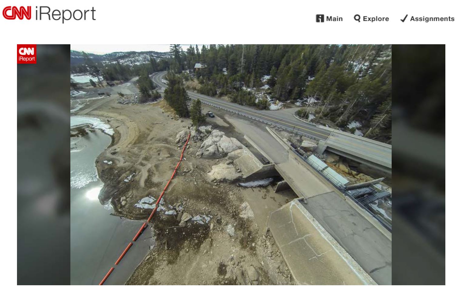
Just west of the pass and close to the top is Silver Lake and Caples Lake. Both lakes are managed by the El Dorado Irrigation District. These lakes are already well on their way to showing the effects of the drought in California.
At Silver Lake, Hwy. 88 crosses right next to the original dam road. It is easy to see when driving by that the water does not even reach the base of the dam. There is a wide stretch of dirt and rocks separating the dam from the remaining water. The orange safety buoys that are usually floating on the surface of the water warning boaters to say back are mostly lying on dry ground. Only a narrow shallow ribbon of water connects the dam to the rest of the receding lake.
A few miles up the road from Silver Lake, and higher in elevation, is Caples Lake. Caples Lake does not appear to be as bad as Silver Lake but the water in Caples Lake is still exceptionally low. It is many feet from the top of the dam to the ice-covered lake below.
On Jan. 13, 2014, the El Dorado Irrigation District announced that the District’s service area has experienced two consecutive dry years, with 2013 being the driest on record. There is a great deal of concern for the water supply outlook heading in to 2014. At this time, the El Dorado powerhouse has been shut down to save some of the water supply in Caples Lake and Silver Lake for future use.
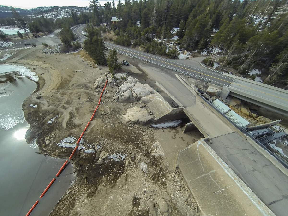
At the very top of Carson Pass is a well-marked hazardous avalanche area. The bright red signs warn not to stop, park, or walk on this section of the road. The sign seems very out of place with the bone-dry mountain behind it.
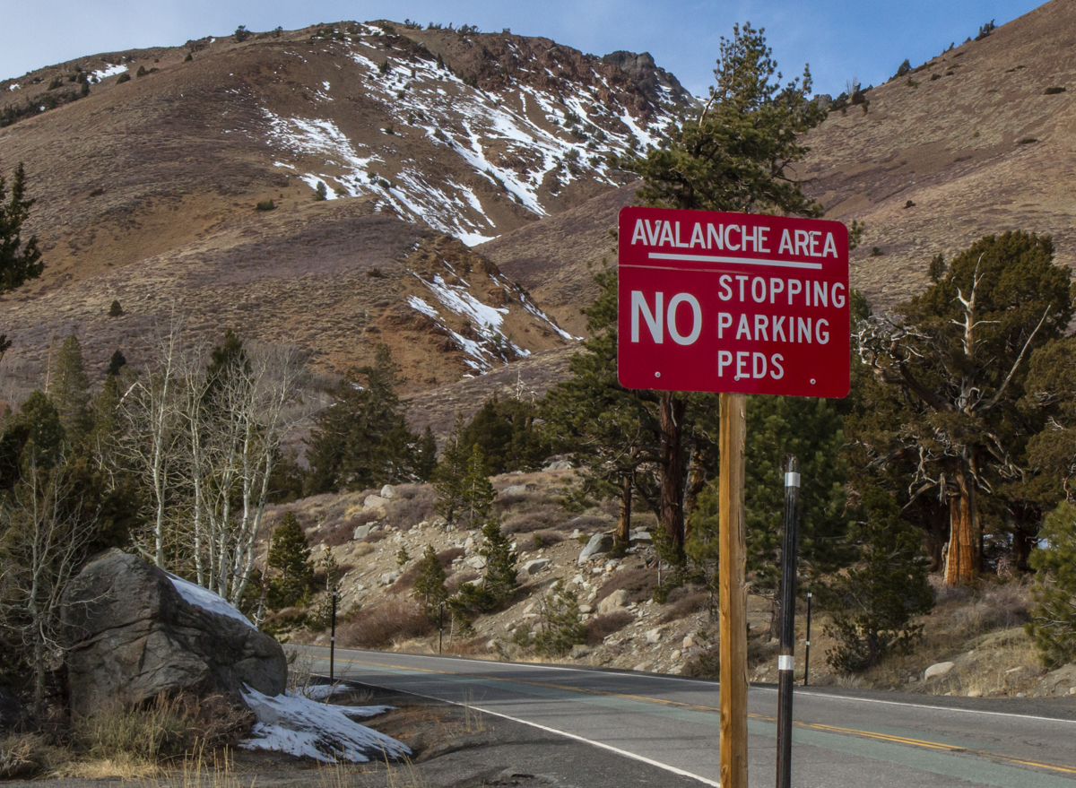
Across from the avalanche prone section of road sits a tower with an artillery gun aimed at the opposing avalanche prone mountain. The gun is used by the California highway department, Caltrans, in its war to prevent deadly avalanches in normal winters. This year the gun sits silent.
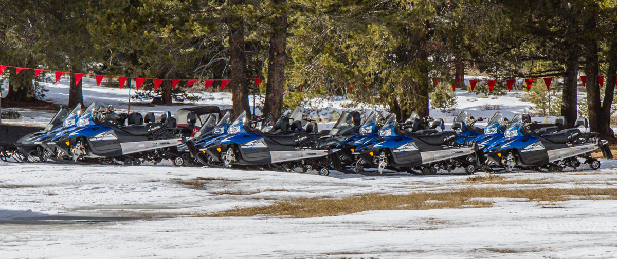
A little farther down the road is the Hope Valley snow park. A local snowmobile tour company has its wintertime snowmobile base at the snow park. Close to one hundred snowmobiles sit parked on ground thinly covered by ice and snow. The snowmobiles sit silent waiting for more snow and tourists to ride them.
Silver Lake
Highway 88 avalanche control
Highway 88 avalanche control

Highway 88 avalanche control
Hope Valley
